The capital of the State is
Santa Fe and though the area had been occupied by Indians and Spaniards long
before the city got its name, the city was Christened La Villa Real de la Santa
Fé de San Francisco de Asís in 1608 as a part of New
Spain. It has a long rich history.
“Between the Lines:
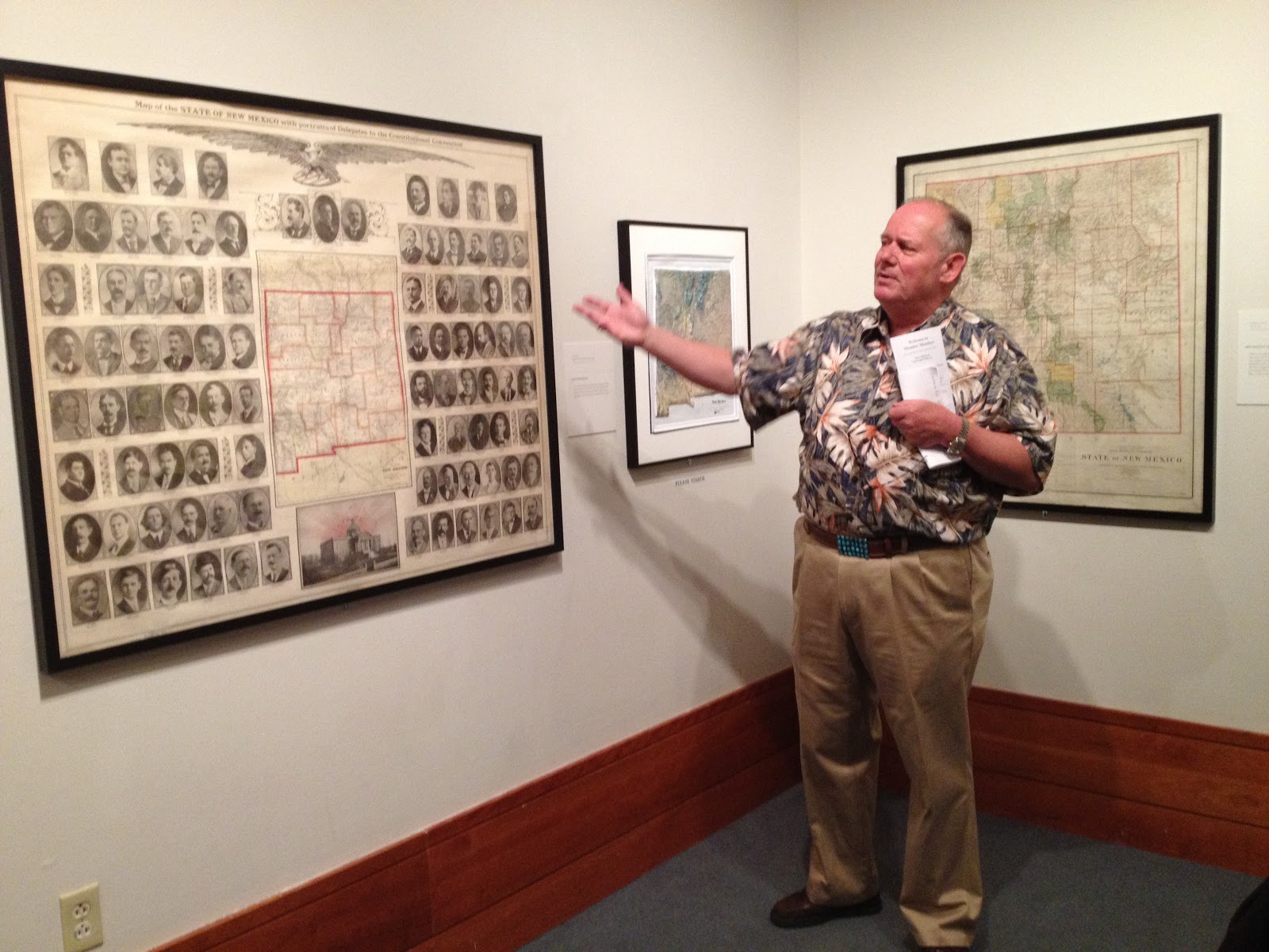
Culture and Cartography on the Road to Statehood” will run only another 10
days. We had the opportunity to have a tour with the two curators of the
exhibition, Tomas
Jaehn, Director
of The Fray Angélico Chávez History Library
which documents the history of the the State and the other was Professor Dennis Reinhartz, a native New Yorker who
taught in England at Oxford University, spent 35 years at various universities
in Texas and wrote 14 books on maps.
Judging from his presentation I might actually buy some! (Images of both curators w. caption)
 |
| Tomas Jaehn |
 |
| Dennis Reinhartz |
I expected it to be quite dull but to my surprise what they had to say was totally fascinating. One of the most interesting things I learned were the political aspects of maps. I had always believed that if it was on a map it was as accurate as possible for the time it was created. It turns out this is not necessarily so. Early maps had lots of blank spaces on them and in the 18th century they often had illustrations occupying these spaces. I thought that the blank spaces represented areas that had been unexplored. While this may have been correct in some cases, we learned that the Spanish knew the Southwest far better than any of the other occupiers who were French, British, American and even Russian, but they considered much of their knowledge to be State secrets so there was an additional reason for the blank spaces.
The first thing I do when I
see a list about something I am involved in is to look for my name. In the case, of a map I look for where I live
or a familiar landmark. I am sure you
know the slight let down if you cannot find it.
So what better way to disenfranchise people than to leave them out and
that is exactly what was done with the Native Americans, they were often
ignored on the maps!

Another obvious fact that I
had never thought about is that maps always have a point of view. They are made with a specific purpose and
often show the prejudice of both the map maker and the person or Country that
commissioned the map. The terms
“Cartographic Imperialism” and “Cartography follows Empire” were used.
Unintentional inaccuracies in
maps can cause issues that can become expensive. The map chosen to establish
the boundaries between the U.S. and Mexico after the war in 1848 was such a
case. Though drawn by an American, it
placed El Paso 34 miles north and 100 miles east of its actual location. This led to the Gadsden Purchase to correct
the error in 1854 which cost the U.S. ten million dollars.

We received practical in
formation as well. That well loved map
in your glove compartment has quickly garnered rips at the seems because it is
made with cheap paper but the maps made before cheap inks and paper were
invented were on vellum which not only lasts longer but when needed is easier
to restore.
When I originally saw the
exhibition I was interested in the history of the State and our town but now a
whole new world has been opened up to me and I will never look at a map the
same way again.
This is great! I haven't heard about this exhibit (maybe because it's a small one), so I'm glad you posted about it. I'll share it with my readers and hopefully they can get over and check it out before it closes.
ReplyDeleteIt is well worth seeing. I guess if you don't get the publicity and there is no promotional material and possibly no press release it is difficult to ge the word around!
ReplyDelete